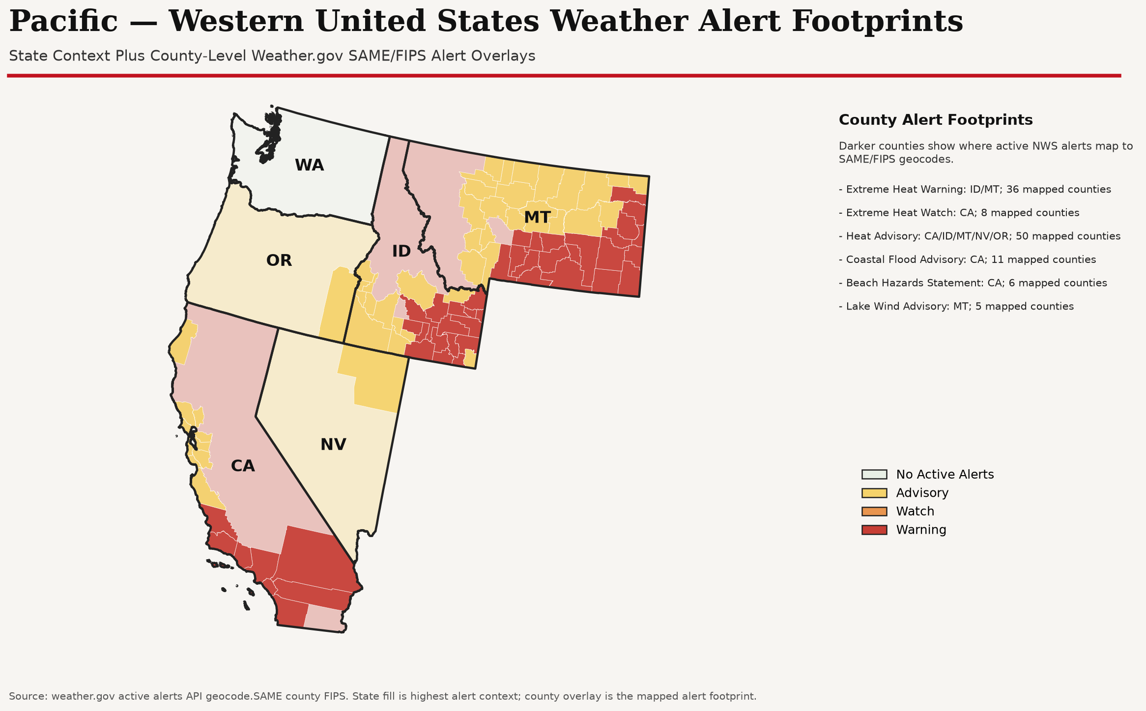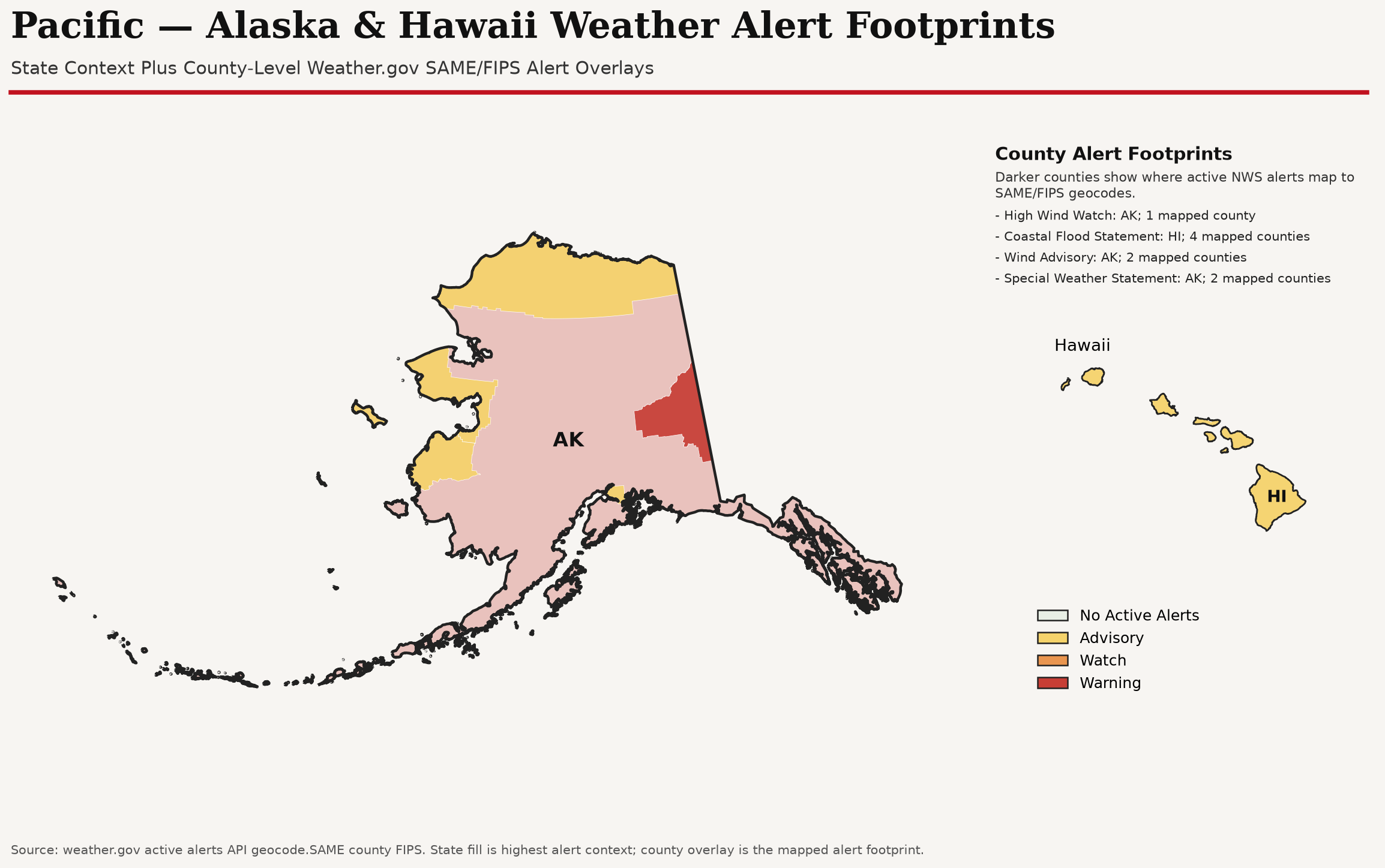
Washington: WARNING Flash Flood Watch, Flood Watch currently returned by weather.gov. Monitor local NWS updates for timing and affected counties.
- WARNING: Flood Watch
No tropical cyclone formation expected in the Atlantic outlook period. 6 Pacific geographies have active NWS alerts; highest current level is Warning in WA.
| Product | Status | Conditions |
|---|---|---|
| NHC | Quiet | No tropical cyclone formation expected in the Atlantic outlook period. Thumbnail/data marked stale; last successful cached view retained. |
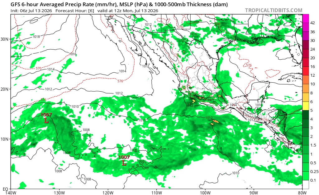
| GFS | Quiet | 11 AM PDT Sep 13 model panel cached for reference. NHC and CPC are the official sources. |
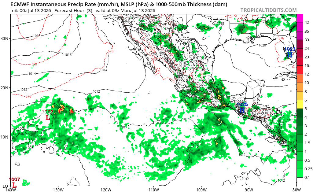
| Euro | Quiet | 5 AM PDT Sep 13 model panel cached for reference. NHC and CPC are the official sources. |
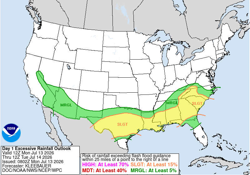
| Excessive Rainfall | Advisory | Flooding or heavy-rain related NWS alerts are active in WA, OR, AK. Use WPC ERO for the official day-by-day rainfall risk. |
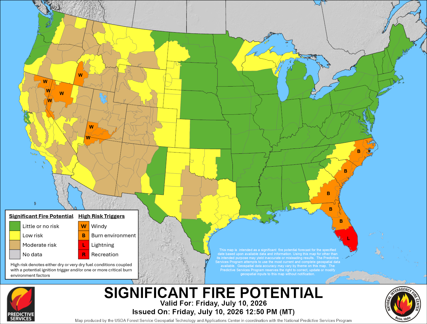
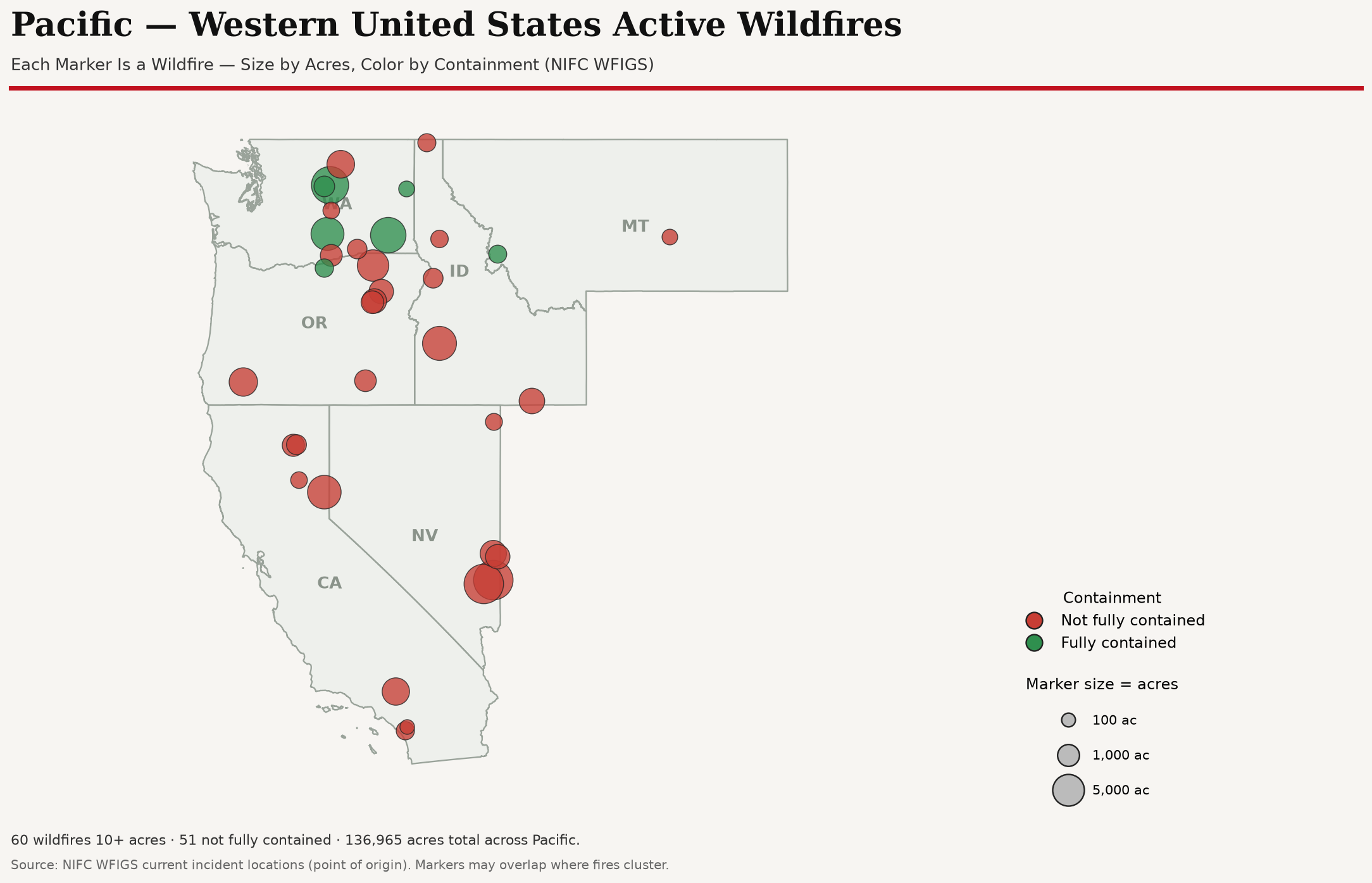
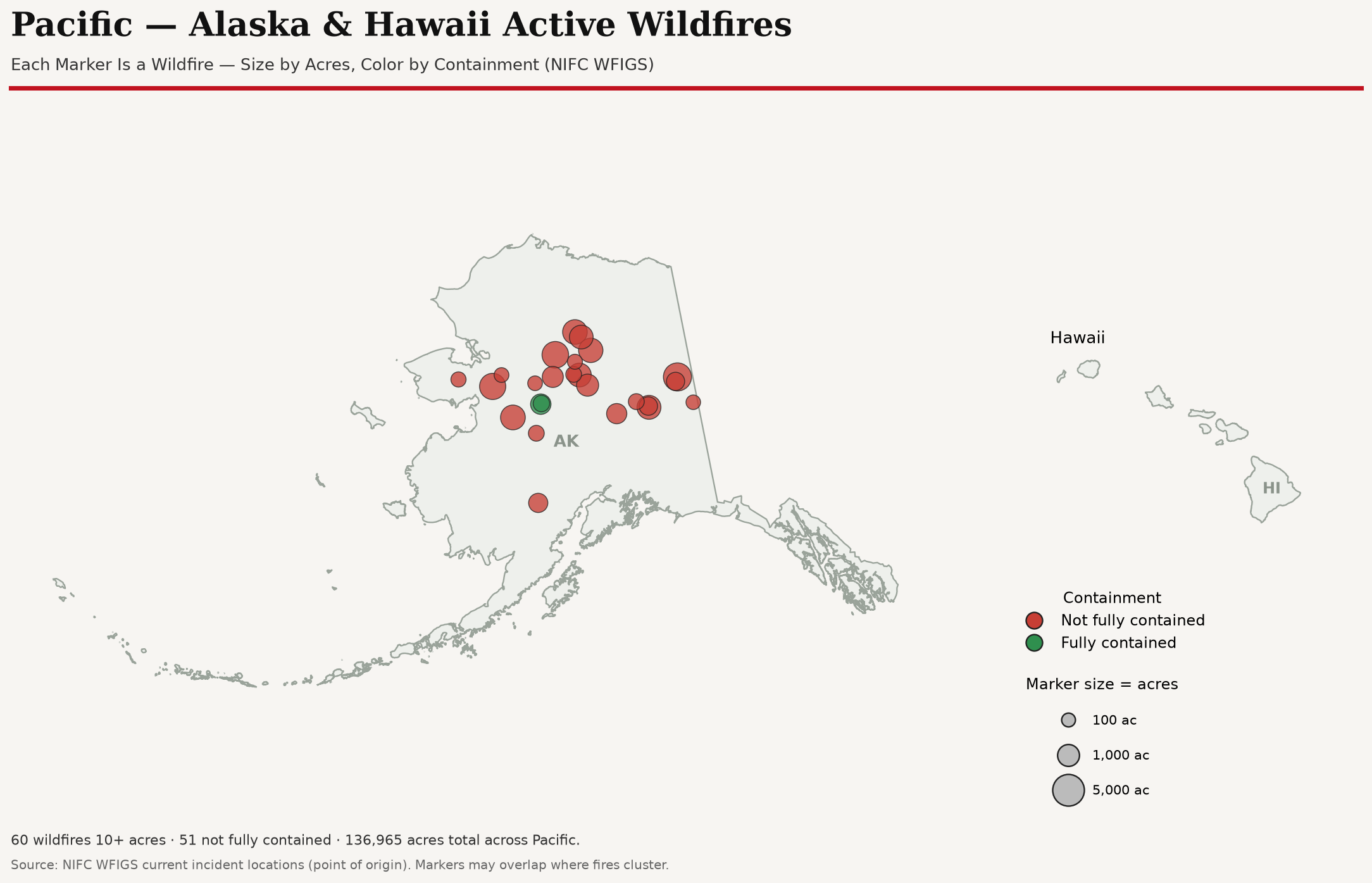
| Active Fires & Potential | Watch | 60 wildfires 10+ acres in Pacific, 36 not fully contained (largest uncontained: 0445 CROSSWHITE, 342,923 acres, 99% contained, OR). NIFC 7-day fire potential outlook cached for reference. |
| Extreme Heat | Quiet | No Pacific heat-specific NWS alerts returned at generation time. Continue heat monitoring through local NWS offices. |
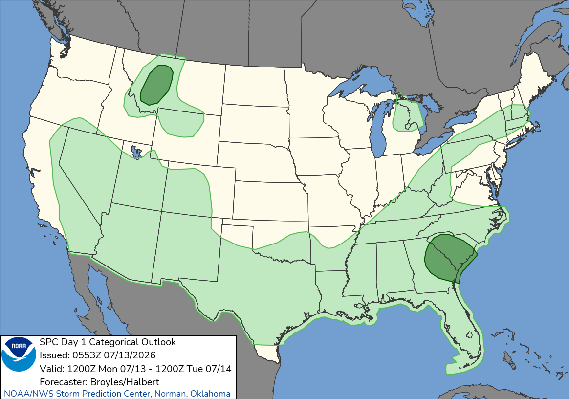
| SPC | Advisory | SPC Day 1 Convective Outlook: General Thunderstorms Risk (ID, MT, NV, OR, WA). Open SPC for the categorical map and forecast discussion. |
| PowerOutage.us | Quiet | Open live dashboard for current outage counts. |
Categorical severe-thunderstorm risk from the Storm Prediction Center, limited to Pacific states. The Day 1 map is shown; open SPC for the full national maps and discussion.
| Area | Level | Active Alerts | Events |
|---|---|---|---|
| Washington | Warning | 5 | Flash Flood Watch, Flood Watch |
| Oregon | Warning | 1 | Flash Flood Watch |
| California | Warning | 4 | Lake Wind Advisory, Red Flag Warning, Wind Advisory |
| Idaho | Advisory | 1 | Wind Advisory |
| Montana | Warning | 5 | High Wind Watch, Lake Wind Advisory, Red Flag Warning, Special Weather Statement |
| Nevada | Quiet | 0 | None returned |
| Alaska | Warning | 12 | Flood Watch, High Surf Advisory, High Wind Watch, Hydrologic Outlook, Special Weather Statement, Wind Advisory |
| Hawaii | Quiet | 0 | None returned |
Washington: WARNING Flash Flood Watch, Flood Watch currently returned by weather.gov. Monitor local NWS updates for timing and affected counties.
Oregon: WARNING Flash Flood Watch currently returned by weather.gov. Monitor local NWS updates for timing and affected counties.
California: WARNING Lake Wind Advisory, Red Flag Warning, Wind Advisory currently returned by weather.gov. Monitor local NWS updates for timing and affected counties.
Idaho: ADVISORY Wind Advisory currently returned by weather.gov. Monitor local NWS updates for timing and affected counties.
Montana: WARNING High Wind Watch, Lake Wind Advisory, Red Flag Warning currently returned by weather.gov. Monitor local NWS updates for timing and affected counties.
Nevada: QUIET No active NWS alerts returned by weather.gov at generation time. Continue routine monitoring for fast-changing heat, storms, rainfall, and local impacts.
Alaska: WARNING Flood Watch, High Surf Advisory, High Wind Watch currently returned by weather.gov. Monitor local NWS updates for timing and affected counties.
Hawaii: QUIET No active NWS alerts returned by weather.gov at generation time. Continue routine monitoring for fast-changing heat, storms, rainfall, and local impacts.
A Special Weather Statement flags a notable weather situation that does not yet meet Advisory, Watch, or Warning criteria. Each one below links to the full issuing-office text so you can see exactly what merited it.
Cascade County below 5000ft; Judith Basin County and Judith Gap; Little Belt and Highwood Mountains
At 540 PM MDT, Doppler radar was tracking a cluster of strong thunderstorms 26 miles southwest of Belt, or 27 miles southeast of Cascade, moving northeast at 35 mph. HAZARD...Wind gusts up to 40 mph and penny size hail. SOURCE...Radar indicated…
Ruby Mountains and Southern Beaverhead Mountains
South to southwesterly winds will continue to impact interstate 15 from Lima to Monida Pass for the remainder of the afternoon. Winds gusts will routinely reach the 50 to 55 mph range, especially over the next couple of hours…
Yukon Delta Coast
We are currently tracking a low that is expected to move north/northeast just off the coast of the YK Delta Monday night into Tuesday. There is still some uncertainty regarding the strength…

Wildfires 10+ acres in Pacific states from the National Interagency Fire Center (WFIGS), largest first. On the map, marker size is acreage and the legend identifies containment; color-vision mode also changes marker shapes. Fire potential is in the Risk Overview.
Wheeler County, OR
342,923 acres · 99% contained
Harney County, OR
308,863 acres · 100% contained
Chelan County, WA
172,695 acres · 81% contained
Okanogan County, WA
166,026 acres · 76% contained
Washington County, ID
158,027 acres · 100% contained
Okanogan County, WA
138,293 acres · 100% contained
Harney County, OR
105,854 acres · 99% contained
Wasco County, OR
94,000 acres · 97% contained
Gilliam County, OR
79,200 acres · 100% contained
Baker County, OR
78,903 acres · 100% contained
Harney County, OR
76,443 acres · 100% contained
Wheeler County, OR
73,183 acres · 99% contained
Jefferson County, OR
70,821 acres · 100% contained
Umatilla County, OR
61,386 acres · 70% contained
Ferry County, WA
57,594 acres · 100% contained
Klamath County, OR
55,134 acres · 98% contained
Nye County, NV
52,000 acres · 100% contained
Gilliam County, OR
50,224 acres · 100% contained
Denali County, AK
38,636 acres · 15% contained
Beaverhead County, MT
35,510 acres · 58% contained
Humboldt County, NV
33,562 acres · 91% contained
Monterey County, CA
29,961 acres · 83% contained
Crook County, OR
29,844 acres · 99% contained
Monterey County, CA
25,426 acres · 39% contained
Okanogan County, WA
25,166 acres · 73% contained
Harney County, OR
24,724 acres · 92% contained
Jefferson County, OR
21,432 acres · 100% contained
Baker County, OR
21,088 acres · 100% contained
Crook County, OR
17,460 acres · 99% contained
Harney County, OR
15,673 acres · 93% contained
Gilliam County, OR
15,658 acres · 100% contained
Custer County, MT
14,056 acres · 100% contained
Jefferson County, OR
13,648 acres · 100% contained
Lincoln County, NV
13,619 acres · 100% contained
Baker County, OR
13,604 acres · 71% contained
Clackamas County, OR
12,881 acres · 56% contained
Gilliam County, OR
11,366 acres · 100% contained
Beaverhead County, MT
10,886 acres · 72% contained
Boise County, ID
10,081 acres · 93% contained
Powell County, MT
9,725 acres · 0% contained
Wallowa County, OR
9,656 acres · 42% contained
Kittitas County, WA
9,527 acres · 20% contained
Wasco County, OR
9,170 acres · 100% contained
Whatcom County, WA
8,171 acres · 73% contained
Whatcom County, WA
7,879 acres · 34% contained
Humboldt County, CA
7,599 acres · 98% contained
Idaho County, ID
7,475 acres · 50% contained
Southeast Fairbanks County, AK
7,335 acres · 70% contained
Flathead County, MT
7,280 acres · 15% contained
Franklin County, WA
7,276 acres · 100% contained
Wheeler County, OR
7,208 acres · 100% contained
Owyhee County, ID
6,936 acres · 100% contained
Wheeler County, OR
6,789 acres · 100% contained
Granite County, MT
6,005 acres · 15% contained
Clearwater County, ID
5,832 acres · 70% contained
Spokane County, WA
5,764 acres · 100% contained
Umatilla County, OR
4,887 acres · 97% contained
Boundary County, ID
4,848 acres · 41% contained
Harney County, OR
4,553 acres · 100% contained
Yukon-Koyukuk County, AK
4,526 acres · 0% contained
Each Pacific state and territory emergency-management agency publishes its own situation reports (SitReps) and updates. These are direct links to the official agency pages for local detail this brief does not pull automatically.
Public aggregate snapshot of current Pacific DROs, shelters, damage assessment, and cases. The scheduled Red Cross Notebook refreshes this alongside the report.
0 operations
| DRO | Incident | Status | Geography | Opened | Open Shelters | Overnight | DA Major / Destroyed | Cases Opened | Cases Closed | Active Cases | Source Updated |
|---|
Aggregates only. No client names, addresses, case records, private item identifiers, service URLs, or access tokens are published.